Monday, January 31, 2011

Indiana Ice Estimates 1/31

Looking over new data for central Indiana. The new 18z run of our RPM forecast model is continuing it's heavy icing roughly along I-70.

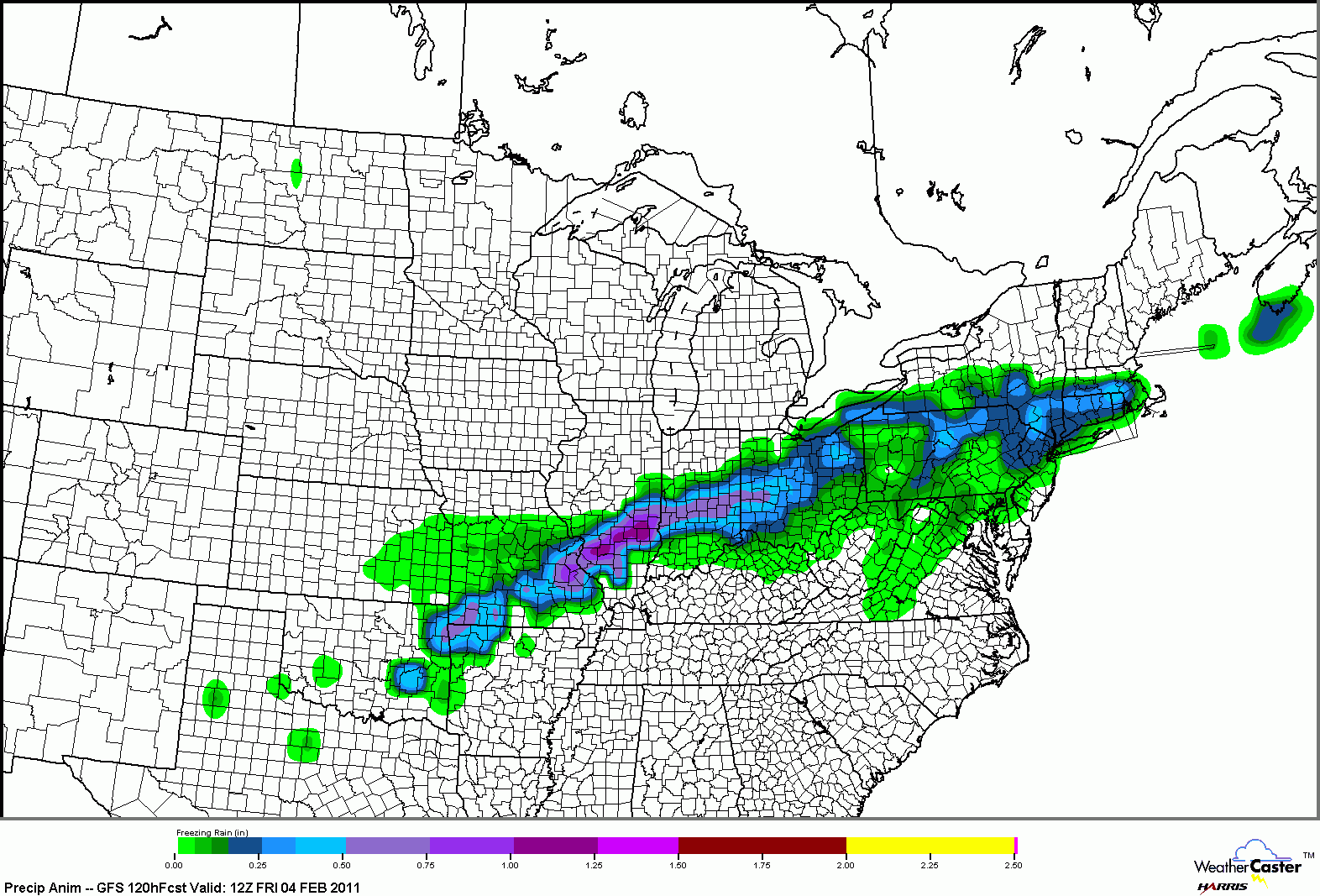
Click map to see larger version.

The above map shows ice accumulation through the duration of the storm. Keep in mind that the track of the surface low pressure will be extremely important for how much ice accumulates and where it accumulates. If the low deviates from the current forecast by even 20-30 miles this numbers above will shift with the low.

For data in the KFVS viewing area watch the video update from the previous posting.

12:50pm Weather Update 1/31

Sunday, January 30, 2011

6:20pm Weather Update 1/30

Surface Low Track 1/30

It is starting to look like the surface low might track far enough north to keep the bulk of the nasty weather out of the KFVS viewing area. That doesn't mean we won't see any of it, just that the worst of it will be north of the area towards St. Louis.

Here is my latest thinking for the track of the surface low over the next 48 hours.

11:35am Weather Update 1/30

The northward shift in latest run of the GFS model, today's 12z (6am CT) run, is a little more apparent when looking at the overall picture.

Freezing Rain Accumulation through 6am CT Friday:


Snow Accumulation through 6am CT Friday:


It is looking like snow is quickly getting out of the picture if the above model is correct. Keep in mind, the storm we are looking for has yet to move over land and a lot of things can change in the models once they get a chance to sample the storm (over land).

11:00am Weather Update 1/30

I am still concerned about the prospects for ice this week. NOAA's Hydrometeorological Prediction Center seems to be looking at ice/freezing rain for a large swath of the country.

Here is their latest Day 3

Click the image to see a larger version.

This paints the 70% or greater probability from parts of southeast Missouri through southern Illinois, southern Indiana, western Ohio and Pennsylvania.

Right now I don't think everyone in the KFVS viewing area is in the bullseye for ice. So far I am thinking we are talking generally north of the Ohio River (extend a line from the Ohio River in to southeast Missouri).

This is far from set in stone. Some data just beginning to come in this morning is hinting at maybe a slight northward shift to the models.

The key in everything for the following days will be the temperature at the surface. If we are cold, 32 degrees or below, any rain we get will be freezing rain. If we can get above 32, even by a degree or two, we are talking just rain.

Stay tuned...

Late Night Data 1/30

Late night run of NOAA's Global forecast model is in and wanted to show you the potential of this storm. It isn't just for the KFVS viewing area, but for much of the country including the St. Louis area, north central Illinois and Indiana.

My biggest concern for the KFVS viewing area is ice with this system. It all depends on how the storm tracks. If it is further south, then we could have more sleet and snow and less ice. If it tracks further north than it could be all rain.

Here is the 0z (6pm CT) GFS model's accumulated freezing rain map.

Click the image to see a larger version.

Here is the 0z (6pm CT) GFS model's accumulated snow map.

Click the image to see a larger version.

Needless to say, this is going to be a BIG storm. Stay tuned...

Saturday, January 29, 2011

Lots of.... 1/29

Going over weather data for Tuesday and Wednesday and I am not liking what I am seeing.

There is still a lot of disagreement between the models as to the exact track of the storm and the track will be everything.

What the models are pretty sure of is a storm developing over western Texas by late Monday night. The storm will quickly track to the northeast.

Another thing the models are all indicating is a lot of moisture for the storm to work with. This is the first southern track storm of the winter for the KFVS viewing area and it appears it is going to have an ample supply of moisture from the Gulf of Mexico.

Early indications of what kind of precipitation from NOAA's Global forecast model is something that this area doesn't want to hear about. Ice.

Here is a look at the what this morning's GFS model is showing for Cape Girardeau.

Click the image to see a larger version.

To read the above chart, time goes from right to left. The thin red line is the surface temperature. The vertical bars indicate moisture. Green is rain. Blue is snow. Orange is sleet. Red is freezing rain (ice).

You can see that the model starts the area with a little bit of rain as the surface temperature is in the middle 30's. I have drawn a horizontal blue line in the chart to indicate where the 32 degree line is located. Notice that once the surface temperature drops below the 32 degree mark the precipitation changes over to freezing rain.

As I mentioned above the models are keeping this system very wet. The GFS is suggesting 1.14" of rain falling as freezing rain.

Just north of the area towards St. Louis the model is keeping it all snow and a lot of snow at that. It is suggesting 14"-18" of snow for St. Louis Tuesday in to Wednesday.

Let me remind you that the above information is data from ONE computer model run. It is NOT our forecast. This means I don't want anyone flipping out. On my "FREAK OUT" scale, right now I would put it at a 4. (1-nothing to worry about to 10-run for your life!!!)

This is still a very fluid situation and the storm has yet to develop. There will be some flip-flopping of the models over the next two days as they try to get a better handle on the storm. Stay tuned...

On a side note I am still in the process of trying to get over whatever this nasty sickness thing I've had for almost a week. I am hoping to be able to go back in to work tomorrow.

Friday, January 28, 2011

System to Watch 1/28

Eyes are looking towards the next round of active weather which should arrive Tuesday and/or Wednesday. Forecast models are still at an early stage of trying to lock on to the pattern and how the storm will track.

Here is a look at the latest run of the European forecast agency's computer model for 6pm CT Tuesday.


Here is a look at this morning's run of NOAA's Global forecast model for 12am CT Wednesday.


There are a few subtle differences between the two runs. For instance, the European run has the storm a little further north and the GFS has it further south. The further north the storm tracks we would have a better chance at rain. The further south the storm tracks the better chance for frozen precipitation (snow, sleet, or freezing rain/ice).

This is my first time looking over the data and, to be honest, I am just quickly glancing over it. I've been sick since Monday and had a fever for 80+ hours. Today is the first time I have been able to sit up without the world spinning. haha

The storm is over 100 hours away from moving in to the KFVS viewing area so we've got some time. It is something I'll keep an eye on. Expect to see more updates over the weekend.

Monday, January 24, 2011

Becoming a Toddler

In the midst of two rounds of snow for the area I somehow missed an important date. My blog is 2 years old. It has now become a toddler.

New at Dis Hour started started January 17, 2009. In reality the blog started earlier than that, but it was all up in my head. For a year or two leading up to the launch I had been tossing the idea around of creating a blog but I never got around to diving in head first.

Little did I know a week after starting my blog the area would be hit by MAJOR ice storm that crippled southeast Missouri, western Kentucky, northwest Tennessee and northeast Arkansas for weeks.

There are several things I like about having the blog. It gives me more time to discuss what is going on. Sometimes it is very difficult to give information about upcoming weather events plus give the short term weather forecast in three minutes or less.

It allows me to go in to more detail and give you a "behind the scenes" view of what I am looking at. Lets face it, a lot of the things I talk about here I couldn't show on TV, especially in three minutes or less. Most people would come away thinking, "What did he just say?"

The blog also gives me a chance a chance to archive what is going on at the moment. Everyone once in a while I find it interesting to go back and read some of the old posts. It takes me back and reminds me of things that happened with storms that passed through. This also allows me to archive what the forecast models were showing at the time. As we have seen, forecast models tend to jump around from one run to the next.

It is easy to go back and look at past posts. All of my posts are organized by year and month on the right side of the page. Just click on the year or month and you will see all of the posts.

I want to thank YOU, the viewers, listeners and readers for coming to my site. When I first started this adventure I didn't expect to even a quarter of the traffic the page currently gets.

Dissauer.com will continue to evolve over the months and years to come and I hope you find it useful. Again, THANK YOU for taking part in the adventure!

Here is to another great year and many more years to come.

Sunday, January 23, 2011

9:30am Weather Update 1/23

Looks like my gut is winning out. Snowfall amounts will be light in areas that see snow. I think there are going to be many areas that get nothing.

The National Weather Service has canceled the Winter Weather Advisories in effect for the KFVS viewing area and the for St. Louis. You can get the latest watches and warnings by clicking on the "Watchs & Warnings" tab at the top of the site.

You can also check out the radar by using the interactive radar on my site. Click on the "Radar" tab at the top of the site to access the interactive radar.

11:25pm Update - 1/22

The new run of the Global forecast model (GFS) is in and is coming in line with my thinking. The amounts have dropped quite a bit. It is indicating maybe 0.5" for Cape Girardeau, 1.5" for Farmington, 0.2" for Paducah and 1.8" for St. Louis. Maybe my gut has been on to something after all.

Saturday, January 22, 2011

10:25pm Weather Update 1/22

It has been interesting this afternoon trying to figure out what this Alberta Clipper is going to do for the KFVS viewing area Sunday and Monday.

From day one this has not looked like a big deal. Maybe a couple of inches and that is it. Through the day today each run of the computer models have backed off the amount of moisture available for snow. Tonight's 0z data continues that trend.

So far just a handful of models are in, the NAM, the Rapid Update Cycle (RUC) and the RPM. The NAM has completely taken out snow for southeast Missouri, southern Illinois, western Kentucky and northwest Tennessee. The RUC is also keeping the snow out. (However, it is keeping 2" of snow for St. Louis through 2pm CT Sunday.)

Keep in mind the NAM has performed horribly all winter and the RUC is not one of my favorite models.

The 0z RPM is backing off on the snow totals through Sunday evening indicating only 0.5" to 0.8" of snow for the KFVS viewing area.

This mornings European forecast agency's model, the Canadian forecast agency's model, the United Kingdom agency's forecast model, and the Japanese forecast agency's forecast model were going light with the amount of moisture. Only indicating 0.04" to 0.12". Models were indicating a 10:1 to 13:1 snow to water ratio that would be a 0.4" to 1.5" snow.

NOAA's Global forecast model was the most aggressive of all the models I looked at this morning indicating 0.18" to 0.26" of liquid. That would be a 1.8" to 3.4" snow.

I could be wrong, but I am just not buying the higher amounts yet. My gut is telling me we could get a dusting to 1.5" at the most over the KFVS viewing area through Monday morning.

Let me say again, this isn't going to be a major snow storm. Oftentimes these minor little "wrinkles" are hard to forecast.

7:00pm Weather Update 1/22

Friday, January 21, 2011

Grading the Forecast 1/21

The day after... A time to reflect on what did and what did not happen.

Overall I am pretty happy with my snow forecast. Generally, we saw 2" to 4" of snow across the KFVS viewing area. A few locations had more, a few had less.

Thanks to the National Weather Service in Paducah, Ky they made it easy for me to look at snowfall reports from around the area.

Click the image to see a larger version.

The areas in southern Illinois that saw less than 2" would have been nearly impossible to forecast ahead of time. That would have been more of a "nowcasting" item.

Here is a look at snowfall around the Midwest over the previous 48 hours.

Click the image to see a larger version.

Regionally the forecast worked out well. Central Indiana ended up with 2" to 4" and south central Indiana ended up with 3" to 5.5" of snow.

St. Louis was a little problematic. My forecast called for 6" to 7" around the St. Louis metro area. I thought there could be a few spots higher than that especially on the north/northwest side (out of the metro area). In actuality, amounts were higher. They ranged from 3" to as much as 12" in the metro area.

I knew there was going to be a heavy band of snow setting up somewhere, I just didn't expect it to be in that exact spot. I don't know anyone that nailed that part of the storm. If you do know of someone, let me know, I'd like to shake their hand. haha

Starting Monday, three days in advance, I started mentioning a general 2" to 4" snow for the area. I had mentioned to many, not necessarily on my blog, Cape Girardeau would see 2" to 3" of snow. Cape Girardeau ended up with 3". I'm pretty happy with that!

So... Time for the grade. On a scale of 1 to 10 I would give myself a 9.

I might be a little biased, so how would you grade my snow forecast? (Scroll down the site to see previous posts.) Leave your grade on the comment section here on my blog.

Looking ahead... Yes, there is a system that could bring the KFVS viewing area more snow Sunday/Monday but I am going to enjoy my last day of vacation and I'll take more looks at the storm tomorrow. (I go back to work tomorrow.)

Thank you for your continued support in "New at Dis Hour" at www.dissauer.com.

Thursday, January 20, 2011

Watch Out Overnight

All the excitement of the snow is over but don't let your guard down tonight if you are traveling on roadways, especially in southeast Missouri.

Temperatures are dropping like a rock. We are already down to 6 degrees at the Cape Girardeau airport and 12 degrees at the Poplar Bluff airport.


Visibilities are also dropping over southeast Missouri. Both the airport in Cape Girardeau and Poplar Bluff are down to 1/4" mile indicating dense fog is developing.

You can see a little of the fog from a MoDOT traffic cam along I-55 at mile marker 92 looking northbound. This is located near the Scott City exit and is also near the Cape Girardeau Regional Airport.


The above image was taken at 9:52pm CT.

Fog and temperatures as cold as they are do not mix. Fog is basically tiny water droplets. When you super-cool the water droplets they freeze to anything they touch. This means if you encounter any of the fog there is a good chance there is ice on surfaces.


I don't mean to scare but I want to give you a heads up if you are traveling tonight. If you see fog tonight be careful!

10:45am Update 1/20

They say a picture is worth 1,000 words. That can be true for today as I've been looking at different traffic cameras along I-55 in southeast Missouri.

The view of I-55 soutbound from Perryville, Mo at 10:41am CT:


The view of I-55 southbound from Cape Girardeau, Mo at 10:28am CT:


Notice the lower visibility with the above image. The snow had been coming down at a pretty good clip in Cape Girardeau around the time of the image.

The view of I-55 northbound from Miner, Mo at 10:29am CT:


The view of I-55 southbound from near Hayti, Mo at 10:38am CT:


I just went outside and measured... As of 10:45am CT, I have 1.9" at my place in Cape Girardeau.

8:30am Weather Update 1/20

So far the snow is coming down pretty hard to the north. I have seen reports of 5" to as much as 12.5" of snow around the St. Louis area. My girlfriend, who is in Chesterfield, Mo, says it is still snowing. (I think I have found the band of heavy snow I've been talking about. haha)

The snow is arriving and falling in the KFVS viewing are as I type. Already 1" of snow has been measured in Farmington, Mo, Ste. Genevieve, Mo and Hamilton County, Il. I just went outside and measured 1" of snow in Cape Girardeau, Mo.

Here is a view of I-55 southbound at mile marker 129 in Perryville, Mo around 8:50am CT.

Click the image to see a larger version

Looking over some of the Rapid Update Cycle model numbers this morning puts down the following additional snowfall amounts for spots across the area.
  • Cape Girardeau, Mo - 2.3"
  • Evansville, In - 2.6"
  • Farmington, Mo - 2.5"
  • Jonesboro, Ar - 3.1"
  • Indianapolis, In - 3.6"
  • Paducah, Ky - 1.7"
  • St. Louis, Mo - 1.3"
So how much snow have you had? Leave your amount in the comment section here on my blog. Please say where the snow is at and whether the amount is estimated or is measured.

Wednesday, January 19, 2011

10:45pm Weather Update 1/19

Data seems to be coming in slow tonight. That always seems to be the case when you are on the cusp of the storm beginning.

The new run of the NAM (0z) is in and I am not looking in to it much. Toss it to the garbage. I think it's an outlier. This run of the forecast model is causing a lot of meteorologists to scramble tonight because it has come in a LOT drier for the majority of the KFVS viewing area. It does keep the bulk of the snow north along the I-70 corridor including St. Louis. It is suggesting 6" to 7" of snow for St. Louis (which I can buy).

The 3z (9pm CT) run of the Rapid Update Cycle model is in and is putting down the following snowfall totals through 3pm CT Thursday. (Reminder, the snow won't end in the KFVS viewing area until late afternoon/early evening Thursday.)
  • Cape Girardeau, Mo - 2.1"
  • Evansville, In - 2.4"
  • Farmington, Mo - 1.9"
  • Jonesboro, Ar - 1.7"
  • Indianapolis, In - 3.2"
  • Paducah, Ky - 1.4"
  • St. Louis, Mo - 6.2"
To be honest, I am not a big fan of the RUC model but it is a set of data to look at. ;) The reason the model is only showing data through 3pm CT Thursday is because the model only looks at the next 12 hours. Because of the short period of time it is looking over it can be higher resolution and the model can be run every hour.

NOAA's global forecast model is far enough in I can look at the next 48 hours (through 6pm CT Friday). Here is a look at the snow accumulation chart from the GFS.

Click the map to see a larger version.

I have not changed any of my thinking for the snow forecast over the KFVS viewing area. I am going to make a slight adjustment to the St. Louis forecast. (The numbers are going to go up a little.)

As previously posted:

KFVS Viewing Area: Generally 2" to 4" of snow. I think we could get a few 5"+ amounts in northern parts of the KFVS viewing area (St. Francois, Ste. Genevieve, Randolph, Washington (IL), Jefferson and Wayne (IL)). An isolated 6" isn't out of the question. Snow over the southern counties (northeast Arkansas, the Missouri bootheel and northwest Tennessee) could see 1" to 2".

The bulk of the snow will start early Thursday morning and end Thursday afternoon lasting around 10-11 hours.


St. Louis: Snow will start later this evening and last through late morning Thursday. I am thinking 4"to 7" will be possible in the St. Louis metro area.

Central Indiana: Areas around the Indianapolis metro area will be 3" to 5" with the lower amounts on the northside. The further south from Indianapolis the higher the amounts will be. Places like Columbus, Bloomington and Seymour could see 3" to 6".

I have also been getting a lot of people asking, "Where's the snow you've been talking about?" All along I've been saying the accumulating snow won't arrive until Thursday morning. The snow will accumulate through the day and then move out by late afternoon/early evening. In other words, don't be surprised if you wake-up and there is no snow on the ground. Give it time...

11:30pm UPDATE: The numbers from the 0z GFS are in. Here are the specific liquid and snow ratios for specific locations across the region.

(City - Liquid) | 10:1 | 13:1 | 15:1 | 17:1 | 18:1
  • Cape Girardeau, Mo - 0.19" | 1.9" | 2.5" | 2.8"
  • Evansville, In - 0.26" | 2.6" | 3.4"
  • Farmington, Mo - 0.20" | 2.0" | 2.6" | 3" | 3.4"*
  • Jonesboro, Ar - 0.19" | 1.9" | 2.1"*
  • Indianapolis, In - 0.22" | 2.2" | 2.8" | 3.3" | 3.7" | 4"
  • Paducah, Ky - 0.20" | 2" | 2.6"
  • St. Louis, Mo - 0.38" | 3.8" | 4.9" | 5.7" | 6.5" | 6.8"
*The ratio has been slightly altered to better reflect what the computer model was indicating.

I still feel good about my current forecast.

11:45am Weather Update 1/19

The most important morning numbers are in. I have been waiting to see what NOAA's Global forecast model would show for Thursday's storm. Mainly to see if the model trended drier like the NAM did earlier, stayed the course or increased the moisture in this system.

Similar to the NAM, the GFS has taken surface temperatures a little higher for places like Cape Girardeau, Mo, Paducah, Ky and Jonesboro, Ar. This means that the all important snow/liquid ratio won't be as high compared to places like Farmington, Mo and St. Louis, Mo where it will be colder.

The GFS is cranking out the following liquid moisture amounts:
  • Cape Girardeau, Mo - 0.19"
  • Evansville, In - 0.23"
  • Farmington, Mo - 0.29"
  • Jonesboro, Ar - 0.19"
  • Indianapolis, In - 0.23"
  • Louisville, Ky - 0.27"
  • Paducah, Ky - 0.19"
  • St. Louis, Mo - 0.39"
You can compare those numbers to this morning's NAM run and last night's GFS run. In some places it was a little drier compared to last night's GFS and in some places it is about the same. I think it is more the model honing in on the storm.

Snow ratios for the locations listed above will range from 9:1 to as much as 18:1 according to the GFS. Knowing that, time to do some math...
  • (City - Liquid) | 10:1 | 13:1 | 15:1 | 16:1 | 18:1
  • Cape Girardeau - 0.19" | 1.9" | 2.5" | 2.9"
  • Evansville, In - 0.27" | 2.7" | 3.5" | 4"
  • Farmington, Mo - 0.29" | 2.9" | 3.8" | 4.4" | 4.6" | 4.9"*
  • Jonesboro, Ar - 0.19" | 1.7"* | 2.1"*
  • Indianapolis, In - 0.23" | 2.3" | 3" | 3.5" | 3.7" | 4.1"
  • Louisville, Ky - 0.27" | 2.7" | 3"*
  • Paducah, Ky - 0.19" | 1.0" | 2.2"*
  • St. Louis, Mo - 0.39" | 3.9" | 5.1" | 5.8" | 6.2" | 7"
*Numbers calculated with an adjusted snow/liquid ratio.

Here is a view of the national snow accumulation map generated from the GFS model.

Click the map to see a larger version.

The model continues the trend of producing a narrow band of large snow totals that run along I-70 through Missouri and just south of I-70 through south central Illinois and through south central Indiana.


I should note that the European forecast agency's computer model just came in and is putting out approximately the following liquid amounts: Cape Girardeau - 0.30" St. Louis - 0.42" Indianapolis - 0.25".

My thoughts on snow amounts haven't changed much.

KFVS Viewing Area: Generally 2" to 4" of snow. I think we could get a few 5"+ amounts in northern parts of the KFVS viewing area (St. Francois, Ste. Genevieve, Randolph, Washington (IL), Jefferson and Wayne (IL)). An isolated 6" isn't out of the question. Snow over the southern counties (northeast Arkansas, the Missouri bootheel and northwest Tennessee) could see 1" to 2".

There are some indications we could see snow falling over Iron, Reynolds, St. Francois, and Ste. Genevieve counties in southeast Missouri as early as 8:00pm CT this evening. The bulk of the snow will start early Thursday morning and end Thursday afternoon lasting around 10-11 hours.


St. Louis: Snow will start later this evening and last through late morning Thursday. I am thinking 4"to 6" will be possible in the St. Louis metro area. I wouldn't be surprised to hear of a few 7" amounts around St. Louis.

Central Indiana: Areas around the Indianapolis metro area will be 3" to 5" with the lower amounts on the northside. The further south from Indianapolis the higher the amounts will be. Places like Columbus, Bloomington and Seymour could see 3" to 6".

What's More Important 1/19

I sent out a message over Twitter this morning that seems appropriate... "Just waking up. What's more important cereal or weather data? Hmm..."

The first round of data coming in is always NOAA's North American Mesoscale Model aka the NAM. The NAM is in and lets look at the data.

The model appears to have come in a little drier with the storm for Thursday. This takes my confidence level in the model up a notch as the NAM has been going a little gangbusters with the precipitation numbers in the last couple of days.

Here is the liquid precipitation the model is depicting for the area through Friday morning.
  • Cape Girardeau, Mo - 0.13"
  • Evansville, In - 0.21"
  • Farmington, Mo - 0.25"
  • Jonesboro, Ar - 0.28"
  • Indianapolis, In - 0.26"
  • Paducah, Ky - 0.13"
  • St. Louis, Mo - 0.24"
I have also noted that the model is trying to bring in slightly warmer air to the surface. For places like Cape Girardeau and Paducah it keeps the temperature around 30 degrees versus the middle 20's it was showing yesterday. This would keep the snow ratio a little lower than the model was advertising yesterday. This has been something I figured would be the case, lower snow/liquid ratio, for this system.

Time for a little math... I am thinking snow ratios will be anywhere from the general 10:1 to 13:1 across the KFVS viewing area. Over some of the northern counties of the KFVS viewing area it could creep up to 15:1. For St. Louis and Indianapolis snow ratios will be around 15:1 to 16:1.

(City - Liquid) | 10:1 | 13:1 | 15:1 | 16:1
  • Cape Girardeau, Mo - 0.13" | 1.3" | 1.7" | 2"
  • Evansville, In - 0.21" | 2.1" | 2.7" | 3.2"
  • Farmington, Mo - 0.25" | 2.5" | 3.3" | 3.8" | 4"
  • Jonesboro, Ar - 0.28" | 2.8" | 3.6"
  • Indianapolis, In - 0.26" | 2.6" | 3.4" | 3.9" | 4.2"
  • Paducah, Ky - 0.13" | 1.3" | 1.7"
  • St. Louis, Mo - 0.24" | 3.1" | 3.6" | 3.8"
Overall, the NAM has taken the snow numbers down from the last two runs. (Last evening's run. Yesterday morning's run.) Is the model on to something new or is it having trouble resolving the storm as the storm is not out of the Rocky Mountains yet?

I still believe there will be a narrow band of heavy snow setting up somewhere north of the KFVS viewing area. It may include the St. Louis area over to Terre Haute, Indiana or Vincennes, Indiana over through south central Indiana.

Here is a regional view of the snow accumulation from this morning's NAM.

Click the map to see a larger version.

I am going to stay the course with my initial thoughts as to how much snow we will see.

KFVS Viewing Area: Generally 2" to 4" of snow. I wouldn't be surprised if we get a few 5" snow amounts from some of the northern counties (St. Francois, Ste. Genevieve, Randolph, Washington (IL), Jefferson, Wayne (IL), Perry (IL), Franklin and Hamilton). The duration of snow will be around 10-11 hours starting early Thursday morning and ending Thursday afternoon. Snow over the southern counties (northwest Tennessee/Missouri bootheel) might range from 1" to 2".

St. Louis: Snow will start later this evening and last through late morning Thursday. I am thinking 3"to 6" will be possible in the St. Louis metro area with higher amounts on the north/northwest side.

Central Indiana: Areas around the Indianapolis metro area will be 2" to 4" with the lower amounts on the northside. The further south from Indianapolis the higher the amounts will be. Places like Columbus, Bloomington and Seymour could see 3" to 6".

Moisture is beginning to breakout over Nebraska and Kansas so the storm is developing as we speak. You can check out the moisture by clicking on the "Radar" tab at the top of the website. You can move/zoom around the country to see where the rain/snow is located.

We will get a couple of more model runs in before the snow starts to fall so keep checking back for updates through the day.

Last New Numbers Tonight 1/18

The last set of numbers I have been looking for are in from NOAA's Global forecast model.

Similar to the NAM numbers from earlier, lets look at how much liquid the model is generating for Thursday's storm for specific points across the area.
  • Cape Girardeau, Mo - 0.25"
  • Evansville, In - 0.37"
  • Farmington, Mo - 0.37"
  • Indianapolis, In - 0.25"
  • Paducah, Ky - 0.23"
  • St. Louis, Mo - 0.40"
The GFS, much like the NAM, is suggesting snow/liquid ratio's will be high... 12:1 to as high as 19:1. I am still not completely sold on the high end ratios just yet, but the models have been very consistent indicating higher ratios partly due to the cold air expected to be in place.

I will do a little math similar to what I've done on the other computer model runs from earlier today. I'll put the basic 10:1 ratio, ratios that I think we could see and the high end ratio the model is suggesting (xx:1).
(City - Liquid) | 10:1 | 12:1 | 15:1 | xx:1
  • Cape Girardeau, Mo - 0.25" | 2.5" | 3" | 3.8"
  • Evansville, In - 0.37" | 3.7" | 4.4" | 5.5"
  • Farmington, Mo - 0.37" | 3.7" | 4.4" | 5.5" | 6.3"
  • Indianapolis, In - 0.25" | 2.5" | 3" | 3.8" | 4.5"
  • Paducah, Ky - 0.23" | 2.3" | 2.8" | 3.5"
  • St. Louis, Mo - 0.40" | 4" | 4.8" | 6" | 7.2"
Seeing the GFS come in with slightly higher numbers gives me a little more confidence that the numbers might be a little higher. Everything is still fitting within the range I mentioned in my previous post and I still think a heavy band will set up somewhere just to the north of the KFVS viewing area.

One thing to note about the above numbers and the storm in general... The storm is still stuck up in the Rocky Mountains. It hasn't developed yet. We won't start to see any signs of the storm until late Wednesday morning. If you tune in to Heartland News at Noon on KFVS12 you will most likely see snow breaking out over western Nebraska. If we see the radars starting to light up over the Plains, then we know everything is on schedule.

Over the years I have seen a number of storms look good on paper as they have come off the Pacific Coast. Then they go in to the Rockies and they get ripped apart and don't come out like the models were projecting.

Right now, I would say the likelihood of schools calling off classes Thursday (if not going home early) and Friday is increasing. Stay tuned...

Tuesday, January 18, 2011

9:50pm Update 1/18

More of the NAM model is in and I am starting to get specific numbers for across the area.

The 0z (6pm) NAM is putting down the following liquid precipitation amounts:
  • Cape Girardeau, Mo - 0.24"
  • Evansville, In - 0.28"
  • Farmington, Mo - 0.23"
  • Jonesboro, Ar - 0.25"
  • Indianapolis, In - 0.15"
  • Paducah, Ky - 0.25"
  • St. Louis, Mo - 0.45"
All of the models are wanting to keep the snow to liquid ratio higher than usual. The general rule is 10:1. That can wildly vary depending on several things including the surface air temperature. The models are hinting at anywhere from a 13:1 to as much as 17:1 ratios. I have a hard time buying in to the 17:1 numbers. I think we could have anywhere from a 10:1 to a 14:1 ratio.

Time to do a little math and break down the above liquid numbers even more. I'll put the ratios that I think are more realistic and I'll include the higher ratios where indicated by the models.

(City - Liquid) | 10:1 | 14:1 | xx:1
  • Cape Girardeau, Mo - 0.24" | 2.4" | 3.3"
  • Evansville, In - 0.28" | 2.8" | 3.9" | 4.5"
  • Farmington, Mo - 0.23" | 2.3" | 3.2" | 3.9"
  • Jonesboro, Ar - 0.25" | 2.4" | 3.5" | 3.6"
  • Indianapolis, In - 0.15" | 1.5" | 2.1" | 2.9"
  • Paducah, Ky - 0.25" | 2.5" | 3" | 3.3"
  • St. Louis, Mo - 0.45 | 4.5" | 6.3" | 7.2"
The hi-res RPM model is also in. It is putting out some decent numbers on the latest run (0z).


To be honest, the RPM has been bouncing around with the snow numbers with this storm.

I still feel comfortable with my numbers previously mentioned. Generally 2" to 4" of snow across the area. Areas over the southern part of the KFVS viewing area might be a little below that and some of the northern counties of the KFVS viewing area could go up to 5" to 5.5".

In central Indiana I think the heaviest amounts will be south of Indianapolis. Indy metro could see anywhere from 2" to 4". Further south towards Columbus and Bloomington I think there could be 3" to 6".

I think there is going to be a narrow band of higher totals that stretches from Missouri through south central Illinois and through south central Indiana. The million dollar question... Where is the band going to set up? I don't know right now. For the most part I think the band will be north of the KFVS viewing area, but I wouldn't be shocked if the band clipped a little of our northern counties.

Data Coming In 1/18

New data is just starting to trickle in. I wanted to put this up on here so you can get an idea what the new run of the NAM forecast model is showing.


The above map shows snow accumulation through the first 60 hours of the model run (through 6am CT Friday). Click the map to see a larger version.

From looking at the map the model seems to be pretty close to what I have been thinking all along for this "storm". It does appear the NAM has backed off a little with the moisture numbers. (Remember... The NAM was going gangbusters earlier today with liquid.)

I don't have specific numbers yet so I can't give specific numbers like I did on posts earlier today. Once those numbers are available I will try to get them compiled and pass them along.


Reminder: This is just one of many models to look at and this isn't the forecast for snow accumulation. It is just one model's depiction.

By the way, do you like seeing the specific numbers like I showed earlier today or would you rather me keep all the numbers out of the blog?

Winter Weather Advisory

The National Weather Service offices in St. Louis and Paducah have issued Winter Weather Advisories. The advisories from each office starts and ends at different times, but generally they are in effect from Wednesday night through Thursday afternoon.

You can visit the Warnings & Watches page here on Dissauer.com to see the full county by county breakdown. Click on the individual county and you can look at the text of the Advisory from the National Weather Service.

11:00am Weather Update 11/18

This is a follow-up post from my previous entry. Thought I would go ahead and update the new numbers just in from NOAA's Global forecast model.

The 12z GFS model is putting down the following liquid precipitation amounts (the amount of moisture to work with):
  • Cape Girardeau, Mo - 0.23"
  • Evansville, In - 0.39"
  • Farmington, Mo - 0.32"
  • Jonesboro, Ar - 0.18"
  • Indianapolis, In - 0.22"
  • Paducah, Ky - 0.24"
  • St. Louis, Mo - 0.36"
Interesting to note that the GFS is a little colder than the NAM. This would take the snow ratio a little higher. The model is suggesting a ratio of 10:1 to 14:1. I think 14:1 is a little high. Maybe 13:1 would be more realistic. (The model is suggesting a 13:1 to 17:1 ratio for St. Louis and Indianapolis. I think the high end is not realistic at this point.)

We do the math and we get the following snowfall amounts.
(City - Liquid | 10:1 ratio | 13:1 ratio)
  • Cape Girardeau, Mo - 0.23" | 2.3" | 3"
  • Evansville, In - 0.39" | 3.9" | 5.1"
  • Farmington, Mo - 0.32" | 3.2" | 4.2"
  • Jonesboro, Ar* - 0.18" | 1.4" | 2"
  • Indianapolis, In* - 0.22" | 2.6" | 3.3"
  • Paducah, Ky - 0.24" | 2.4" | 3.2"
  • St. Louis, Mo* - 0.36" | 4.3" | 5.7"
*Adjusted for what I think is a more realistic snow to liquid ratio.

Generally, the liquid amounts are similar to what the NAM is suggesting.

The GFS is indicating the snow will begin to fall in St. Louis late Wednesday afternoon. It will start Thursday morning for Cape Girardeau, Farmington, Jonesboro, Indianapolis and Paducah.

I should mention that it appears the temperature is going to drop behind this system. Models are hinting at highs in the upper teens Friday (single digits in St. Louis and Indianapolis).

Note: The data listed above is from data provided by NOAA. I know there are portions of the KFVS viewing are not listed above. I have tried to include areas that are either in or surround southeast Missouri, southern Illinois, western Kentucky and northwest Tennessee. Look at the above list and find a location near you. Then find a second and you can extrapolate the information.

9:30am Weather Update 1/18

I am taking a closer look at the details of the Thursday storm that will impact southeast/east Missouri, southern Illinois, western Kentucky and central Indiana.

Not all of the data is in from the morning computer models I look at but the data that is keeps me a little interested in the storm.

I am still relatively confident that this storm will be all snow so lets talk about how much liquid is available.

This morning's 12z NAM model is putting down the following liquid precipitation amounts:
  • Farmington, Mo - 0.43"
  • Cape Girardeau, Mo - 0.25"
  • Indianapolis, In - 0.48"
  • Paducah, Ky - 0.20"
  • St. Louis, Mo - 0.35"
Generally speaking, I am thinking we will see a 9:1 to as much as a 12:1 snow ratio for the KFVS viewing area. The ratio may be a little higher for St. Louis and Indianapolis.

When we do the math we get the following snowfall amounts:
(City - Liquid | 9:1 ratio | 12:1 ratio)
  • Farmington, Mo - 0.43" | 3.9" | 5.1"
  • Cape Girardeau, Mo - 0.25" | 2.2" | 3"
  • Indianapolis, In - 0.48" | 4.8" | 6.2"
  • Paducah, Ky - 0.20" | 1.8" | 2.4"
  • St. Louis, Mo - 0.35" | 3.5" | 4.9"
This is just one of four computer models I look at. Some places to will see less, others may see slightly more, but generally I still think 2" to 4" of snow will be possible across the KFVS viewing area. In central Indiana I think there could be anywhere from 4" to 7" of snow.

And as a little teaser, it looks like we could see an addition round of snow with a fast moving system Sunday night through Monday morning. Stay tuned...

Monday, January 17, 2011

Maybe Some Snow

There has been some chatter in the weather world about an upcoming system that could bring some snow to Missouri, Illinois and Kentucky later this week so I thought I should address it.

As of right now it does not appear to be a big snow maker for the area. Maybe couple of inches and that is about it Thursday.

Let's see what the models are showing us. Here is a look at the new run of NOAA's global forecast computer model. This is for 18z or 12pm CT Thursday.


Here is last night's run of the European forecast agency's computer model depicting the same time period as above, 12pm CT Thursday.


Both models bring enough cold air through the area that we would be talking mainly an all snow event. A look at the profiles support the theory of a couple of inches of snow (perhaps 2" to 4").

The "storm" is still a 70+ hours away... We shall see what happens.

I'm taking a few days off from work so that explains the lack of updates on my blog. Sometimes a person needs to get away from their work to recharge their batteries. I am back in at work Saturday. If there are any big changes to this system I'll try to keep you up to date here or via my Twitter account @johndissauer.

Tuesday, January 11, 2011

Hold on to Your Hat

Snow Reports 1/11

Snow reports from the overnight snow have been slow to come in today.


The map above was created using amounts submitted to the Heartland StormTeam via Twitter and Facebook and also from the National Weather Service.

Thank you to everyone on Twitter and Facebook that have sent in your snow amounts to the Heartland StormTeam and the National Weather Service.

The storm behaved pretty much as expected with amounts generally 1" to 3" from Cape Girardeau and north. I measured 0.9" at my place in Cape Girardeau. Areas with no reports, mainly over southeast Missouri, had anywhere from nothing to a dusting to "not enough to measure".

How much snow did you get? Leave how much, where and whether it the amount was measured or estimated in the comments section.

Monday, January 10, 2011

Slow to Snow

Snow is sloooooowly moving in from the west tonight. It is about on time from what I was thinking earlier. I figured it would start to move into our western/northwestern counties of SE Missouri starting around 10:00pm CT.

I took a look at the Rapid Refresh model (yet another model to gaze). The model is run every hour. Here is the model's depiction of what the national composite radar will look like at 1:00am CT Tuesday.


It is bring the snow through overnight (as expected).

One thing the Rapid Refresh model is hinting at is lower snow totals. Here is the 2z model's accumulated snowfall through 9:00am CT Tuesday.


Earlier runs of the forecast models were suggesting that the snow wouldn't start to pick up in intensity until after midnight, especially through southern Illinois. We shall see...

A reminder about a couple of new blog features. Look to the top of the page and you will see tabs for "Blog", "Radar" and "Watches & Warnings". If you click on the Radar tab you can look at a new interactive radar and if you click on "Watches & Warnings" you can go to an interactive map plotting active watches and warnings for the country.

Update on Tonight's Snow

Sunday, January 9, 2011

10:18pm Update - Reports of Snow

I'm getting reports of snow falling in the far southern sections of the Missouri bootheel (Dunklin and Pemiscot counties).

Senath, Carutherville and Hornersville are reporting snow. I am also seeing reports from viewers in Blytheville, Arkansas and the airport in Blytheville is reporting 3/4 to 1 mile visibilities with light snow.

Here's a look at what the 0z RPM model is suggesting for snow totals.


The RPM is starting to jive a little with my forecast. Scroll down the blog and you will see a post from Saturday morning that has my forecast thoughts.

Numbers Coming In

Numbers are beginning to come in from a couple of the computer models' evening runs. So far I am still feeling pretty good about my initial forecast and don't see any reason to deviate.

0z (6pm) NAM Snowfall accumulation through 6pm Monday:


0z (6pm) RUC Snowfall accumulation through 6pm Monday:


Click on the above images to see larger versions.

6:50pm Weather Update - Two Rounds of Snow

7:00am Weather Update

10:45pm Weather Update

Saturday, January 8, 2011

Getting the Brush

Mother Nature is getting her brush out because it appears that she is going to brush parts of the KFVS viewing area with a little snow.

Let me first say that right now it looks like most of the KFVS viewing area will not going to get snow from the Sunday/Monday system*. Areas that could get a little snow will be the Missouri bootheel, northeast Arkansas, northwest Tennessee and the extreme southeast corner of western Kentucky (i.e. Calloway County, Ky).

This morning's Global forecast model continues the trend of keeping the surface low of the storm along the gulf coast with moisture spreading north.

Here is this morning's 12z run depicting 12am CT Monday.


You can see how the northern edge of the moisture brushes the southern edge of the viewing area.

Last night's Canadian model shows the same thing. Here is the model's depiction of 6am CT Monday.


The only difference between this model and the previously mentioned model is that the Canadian brings a little bit more moisture further north and brings 0.5" of snow to a rough line from Sikeston, Mo to Shawneetown, Il.

As of now... I think that the Missouri bootheel could see anywhere from a dusting to 1.5" of snow. Northwest Tennessee could see 0.5" to 2.5" of snow. There could be a dusting to 1.5" of snow in Calloway County, Ky. (If your location hasn't been mentioned, consider yourself lucky if you get a dusting.)

Notice that I put an asterisk earlier in the blog. Just because you don't get any snow Sunday/Monday doesn't mean you won't see any snow. There is a second round to the storm that will move through early Tuesday morning.

In the models shown above you can see a second wave of moisture moving through the Plains. This is what will move through Tuesday morning.

Models have been hinting at there being enough moisture with the second wave to produce a measurable snow for the northern half of the viewing area.

Here's a look at the Global forecast model Tuesday morning.


This would be a fluffier snow so the snow ratio will most likely be a little higher. A general rule for snow is 1" of water equals 10" of snow. That ratio changes depending on a couple of elements such as air temperature. I think we could see a 14:1 to 17:1 ratio with the Tuesday morning wave. This would mean 1" to 2.5" of snow for the northern half of southeast Missouri and southern Illinois.

One thing that is yet to be determined is how dry the air will be when the second wave comes through. If we are dry, we could cut the above number in half as the moisture that falls will evaporate.

Friday, January 7, 2011

Glancing over the models

I've been looking over the morning models for the Sunday/Monday snow storm developing to the south. Now I want YOU to take a look at the models.

First we'll start with my favorite model, the European forecast agency's model. This is the depiction for 12am CT Monday.


The European model keeps the storm's surface low along the gulf coast but moisture streams north in to southern Missouri. This would indicate that the storm would bring snow to the far southern parts of the KFVS viewing area (northeast Arkansas, extreme southern southeast Missouri, southern western Kentucky, and northwest Tennessee). Roughly speaking, maybe 1" of snow south of the Ohio River and maybe 2"-4" for the Missouri bootheel, northeast Arkansas and northwest Tennessee.

Now let's take a look at NOAA's Global forecast model for 12am CT Monday.


This model is staying pretty consistent keeping all of the moisture south of the KFVS viewing area. In fact, it is keeping the bulk of the moisture over Alabama and Mississippi.

Finally, let's take a look from north of the border. This is the Canadian forecast agency's model. This is the depiction for 6am CT Monday.


The Canadian takes the moisture farther north than any of the models. It would spread 0.5" of snow to almost the northern counties of the KFVS viewing area. It would also bring in more snow for western Kentucky, northwest Tennessee, northeast Arkansas and south of Highway 60 in southeast Missouri.

The Canadian model also brings through another little system for Tuesday. Below is the model's depiction for 6am CT Tuesday morning.


If the Canadian run is correct, a surface low would develop over the top of the KFVS viewing area and move east. Unlike what normally happens with this type of system, the Canadian has cold air in place ahead of the storm. This means that anything falling from it would be all snow. This could be an additional 2"-5" snow for parts of the area if it pans out.

Thursday, January 6, 2011

Keeping an eye on southern storm

I'm keeping an eye on a storm the computer models have been advertising since the end of last week. It is more of a southern storm. The southern storms are ones to watch for the KFVS viewing area as those historically have the largest snow potential.

Right now the models keep the storm south. Maybe a little too far south for us to get a decent snow. However, one of the models brings the storm, and the associated precipitation, far enough north to bring some snow to parts of southeast Missouri, northwest Tennessee and maybe western Kentucky.

The model that brings a little moisture our way is the European forecast agency's computer model. If you follow my blog you know that I am a fan of this model. It has also performed very well the last couple of months.

Here's a look at last night's 0z Thursday run of the model. We're looking at 12am CT Monday.


The model takes the storm along the gulf coast. Notice the precipitation shield. It is rather large. In general terms look at the blue 540 line and figure anything north of that line would be snow. This run of the model indicates a pretty good amount of snow for central Arkansas and areas towards Memphis. This would also bring a little snow, perhaps 2"-4", through northeast Arkansas, the Missouri bootheel, and northwest Tennessee.

Here's a look at the new 12z Thursday run of the model looking at the same time, 12am CT Monday.


This morning's run continues to keep the center of the storm along the gulf coast and spreads precipitation north of the surface low up through Arkansas and Tennessee. This would bring a little snow to northeast Arkansas, the Missouri bootheel, and western Tennessee.

The latest run is showing not as much precipitation on the northern edge of the storm. So maybe 1"-2" of snow for the above mentioned parts of the KFVS viewing area.

In contrast, NOAA's Global forecast model keeps the moisture south of the area bring at best snow flurries to the Missouri bootheel and northwest Tennessee.

The one thing models agree on... the timing. They pass the storm by the area overnight Sunday in to Monday morning.

This is far from a sure thing and is still a fluid situation. The numbers mentioned above aren't the actual forecast. They are just a quick glance number. I've got my eye on it and will provide updates over the next couple of days. As I like to say... Stay tuned.