Wednesday, April 29, 2020

The More You Kmow: Best days to work in the yard end of week and weekend

Scattered showers will remain a possibility though the evening.  The rain should not be widespread over central Indiana.


  • Showers will be possible Thursday morning.  As an area of low pressure moves off to the east, a few lingering showers could remain, especially over eastern Indiana.  Heating of the day may spark a few more showers late afternoon.  So I'll keep it a "yellow".
  • High pressure will keep things dry Friday and Saturday.
  • It looks like we will have rain arrive Sunday but there remains some question as to when it gets here.  One medium-range computer model suggests rain starting Sunday morning and light rain continuing throughout the day.  Another medium-range computer model keeps things dry Sunday morning, scattered showers developing by afternoon, and widespread rain arriving by evening.

Windy this month; Closer look at the windiest month over last three decades

Earlier today I overheard someone talking about how windy it has been recently.  They were suggesting that it is a lot windier than they remember it being.  That conversation sent me in to the depths of weather records.


The data shows that in fact it has been a windy April.  April ranks as the #1 month number of hours with 20+ wind gusts.  April averages 95.5 hours with 20+ wind gusts on average since 1990.  This year April has had 157 hours with 20+ mph wind gusts through April 28.  That is a 64% increase in number of hours.  So yes, it has been a bit windier than usual.

In fact, it is the windiest April in 9 years.  2011 had 184 hours with 20+ mph wind gusts.  We may make a run on that when you factor in today (April 29) and Thursday.

Click image to see larger version.
April is quite a bit ahead of the #2 month, March.  It works out to around 25% more.  That is followed by January.
  1. April
  2. March
  3. January
  4. November
  5. February
  6. May
  7. October
  8. December
  9. June
  10. September
  11. July
  12. August

Allergy Tracker: Brief relief from tree and mold

Rain passing through central Indiana Wednesday morning has knocked down tree and mold allergens for the moment.  Both tree and mold levels are expected to increase later today.

The highest tree allergens later today will be oak, maple/box elder, alder, birch, willow, hickory, mulberry, and cottonwood.

Tuesday, April 28, 2020

The More You Kmow: Evening showers and rain next two days

Such a nice day in central Indiana.  Temperatures this afternoon have climbed in to the 70°s.  Winds are a bit gusty, out of the south-southwest up to 28 mph.

The rest of the afternoon will remain dry.  A couple high-resolution, short range computer models are suggesting a few showers popping up between 5 p.m. and 6 p.m.  This may be a little overdone.  That being said, I am going to keep a chance of a spotty shower in the forecast by evening.  By the way, sunset is 8:37 p.m. this evening.
Rain becomes widespread overnight as a line of decaying thunderstorms arrives in the Hoosier state.  Rain will likely linger through the morning and midday Wednesday.  I'm going to through a yellow - "at your own risk" for the evening as it does appear the rain will let up and become less widespread in coverage.  However, the grass will  be wet.
  • Thursday morning looks to  be wet.  Moisture will be present on the  backside of an area of low pressure, so showers will be likely.  The rain may let up and become more scattered by midday and evening.  It looks be to be windy, especially for the morning and midday.
  • Friday and Saturday look dry as high pressure moves overhead.


Monday, April 27, 2020

The More You Kmow: Nice today but couple chances for rain this week

Today is a great day to fire up the mower and get your yard mowed.  I'll be doing the same later this afternoon.  Do it before a few showers pass overnight.  A couple showers may linger Tuesday morning but should be out of central Indiana by midday.

  • Wednesday is going to be a "No Mow" day.  We should wake up to rain falling.  Showers should continue through the afternoon and evening.  It will also be windy.  Leave the mower in the garage or shed.
  • Computer models suggest rain could linger on the backside of an area of low pressure Thursday morning.  Rain should begin to taper off by mid-morning and be mainly out of the area by afternoon.  It will also be windy morning and afternoon.
  • High pressure builds in Friday keeping it dry.

Sunday, April 26, 2020

Bright lights reported across the sky Sunday night and there is an explanation

If you saw a line of bright lights in the sky over the Midwest tonight (around 10:10 EDT), there is an explanation. They are part of Elon Musk’s Starlink project.  Forbes wrote an article about it a few days ago.

While many people in the Midwest reported seeing the bright lights, I even got a message (with video) from someone in the Caribbean.
Space X launched its seventh Starlink mission Wednesday, April 22, 2020 which included a payload of 60 Starlink satellites.

The project is to place around 12,000 of small satellites in orbit around the planet when the project is completed.  The satellites will be used to provide high speed internet around the globe.

There are only 420 in orbit to date.  I suspect we will have many more sightings of bright objects in the sky once the other 11,580 are placed in to orbit (approximately 350 miles above the Earth's surface).

Check out this video shot in Switzerland on April 24, 2020.  You can see the "train" of satellites crossing the sky.


Did you see the lights cross the sky?  Leave a comment and let me know.

The More You Kmow: Sunshine rest of today but more rain returns

It is a little gusty this afternoon but the sun is out!  Sunset isn't until 8:35pm so there are still a few hours to get outside.  Temperatures will be in the low 60°s in central Indiana.
  • Dry for most of Monday. Chance for a few showers late Monday north.
  • Morning showers Tue. A few sct Tue PM north along warm front.
  • Wet/windy Thursday.

Friday, April 24, 2020

Barometric pressure dropping and rain chances rising at Lake Monroe Saturday

If you are planning on going out on Lake Monroe Saturday pay attention to the forecast.  A few light showers possible around sunrise.  Temperatures climb in to the lower/mid 60° during the afternoon.  Rain arrives by late afternoon.

Anglers... The barometer will be dropping through the day.


The More You Kmow: Tracking chances for rain but there will be dry hours

There are going to  be many dry hours Saturday morning and afternoon afternoon to do yard work.  Southeasterly and easterly winds will due us a favor by helping keep the lower levels of the atmosphere dry.  As rain attempts to move in to central Indiana it will be delayed.  By late afternoon and evening there will be a chance for rain, but a few high resolution computer models suggest not everyone gets rain Saturday evening.

  • Showers linger Sunday morning in southern Indiana and perhaps in to the early afternoon in eastern/southeastern Indiana.
  • Monday looks mainly dry.  Models bring a front through the state Monday night but right now it looks like the rain will be contained to northern Indiana.
  • A few showers will  be possible Tuesday morning before drying out by midday.

Wet start to year looks to continue

Indianapolis has received 15.07" of precipitation this year through April 24.  That makes this the 30th wettest start to a year since 1872 in the Hoosier state capital.


It looks like above normal precipitation will continue for central Indiana.  Long range computer models suggest another 1.37" falling thru Friday, May 1. That works out to 142% the normal (0.96") for the time period.

Allergy Tracker: Relief for some tree pollen allergies

A slight air mass change has dropped tree pollen in the air over central Indiana today.  However, if you have a mold allergy, that will remain high throughout the day.


Tree pollen is projected to increase slightly this afternoon, peaking around 1 p.m.  The highest tree allergens will be oak, willow and maple/box elder.

Thursday, April 23, 2020

The More You Kmow: Tracking couple rounds of rain

Mowing is strongly discouraged this evening around central Indiana as rain continues to fall.  You will be much happier if you wait for Friday to work in your yard.


  • Rain arrives Saturday.  The morning should be fine for mowing.  Question remains regarding arrival of rain Saturday afternoon.  One computer model keeps a southeasterly/easterly wind which often holds the rain off several hours.  Another brings the rain in by late morning.
  • Showers hang around Sunday on the backside of an area of low pressure.  There could be a few showers lingering in to the early afternoon.
  • Dry Monday.

Allergy Tracker: Mold sufferers are likely feeling it today

With higher moisture content in the air due to rain it isn't too surprising to see mold is high now now around central Indiana. Mold levels are expected to increase this afternon.

Tree pollen levels are at moderate right now.  They are expected to increase to high this afternoon.  The highest levels of tree allergens right now are cottonwood, willow, birch, and pine.  This afternoon it is projected to include mulberry, maple/box elder, oak, elm, and elder.

Wednesday, April 22, 2020

Driest April in over a decade

It sure seems like we've had a lot of clouds and rain this month but data suggests a different story.

Over half the days this month have produced precipitation - 12 out of 21 days - officially in Indianapolis.  Twelve days produced rain and one day produced a trace of snow.only recorded 0.67" of precipitation this month.

Interestingly, the amount of rain for the month is relatively low.  Only 0.67" of precipitation has been measured which is quite low.  So low that this is the driest April (through the 21st) in 16 years in the Hoosier state capital.  This month ties for the 8th driest April (through the 21st) since 1871.
It looks like we will make-up for the dry start to the month with several chances for rain to close April.

Rain returns to Indiana Thursday morning, Saturday, Sunday, Tuesday, and next Wednesday.  Long range computer models suggest an additional 1.62" to 2.30" could fall through the end of the month.


Allergy Tracker: Tree and Mold allergens climb later today

The grass is green.  Trees are beginning to bud.  Flowers are beginning to show their colors.  'Tis the season for allergies to kick up.
The latest data shows tree and mold levels are low right now in central Indiana. They are expected to increase later today as winds shift around to the south/southwest.
Grass and weed remains in the clear today.

Tuesday, April 21, 2020

Rare air arrives in central Indiana

Dry air has arrived in central Indiana thanks to a cold front that has passed through the state. The dew point temperature in Indianapolis dropped to 20° officially at 1 p.m. (12:54 p.m. observation).  This is definitely more February-like air than late April.


This is extremely rare air.  So rare that this is the first time since 1942 the dew point has dropped to 20° or less between April 21-31 in Indy according to data collected from the Midwestern Regional Climate Center.

Friday, April 17, 2020

Wet start to the year and end of work week

It has been a damp, dreary, chilly day around central Indiana today.  Northern Indiana even received snow, with as much as 4" of snow reported, late Thursday night in to Friday morning.

Rainfall totals have been relatively light through 4pm.  Bloomington has picked up the most with 0.29".


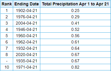
For those of you thinking it has been a wet year you are correct.  Take a look at the numbers for Indianapolis.


Indianapolis has received 14.54" of precipitation for the year which is nearly 4" above normal. It currently ranks as the 24th wettest start to a year since 1872.

For those wanting drier conditions it appears there will be dry time coming over the next week.  Long range computer models are suggesting anywhere from a third to a half inch of rain possible through 8pm Friday, April 24 in Indianapolis.


Drier conditions start Saturday.  So if you need to get yard work done, Saturday is your day.  There will be a weak front passing the area Sunday.  That could bring a few widely scattered showers throughout the day.  Monday looks to remain dry.  Another front will pass through early Tuesday morning bringing with it a few light showers.

Thursday, April 16, 2020

Coldest temperature for date in 145 years

A second consecutive day with temperatures dropping in to the lower 20°s around central Indiana.  It got down as low as 22° just north of Zionsville!

DID YOU KNOW: This was the coldest temperature for April 16 in Indianapolis since 1875 (it dropped to 21°) - ranking the second coldest for the date on record (since 1871).

ADDITIONALLY... This morning was the coldest temperature in #Indianapolis since March 7.


Chance for accumulating snow quickly declining

Lots of talk of snow tonight/Friday for central Indiana but there is light at the end of the tunnel.  Historically speaking, the chances for an accumulating snow is quickly dwindling for the Hoosier state capital.

DID YOU KNOW: Since 1931 only 8 days have recorded measurable snow in Indianapolis from this date thru the end of May.