Tuesday, January 29, 2013

Comments from Conference Call

Just got off a conference call with forecasters from the  National Weather Service office in Paducah, Kentucky.  They brought up some very good things to consider, especially when it comes to nighttime severe weather.

Here are a couple of comments Warning Coordination Meteorologist Rick Shanklin made during the call that I found noteworthy to pass along.
  • Have more than one way to be warned of severe weather overnight.  Along with a weather radio, call family/friends that are in the path of the warned storm.  They found that having someone be warned by a phone call made the person(s) more likely to “wake-up” and take action.
  • Leave mobile homes when a watch is issued for your area instead of waiting for a warning.  This is especially true with overnight storms.  71% of deaths from tornadoes in southeast Missouri, southern Illinois, western Kentucky and southwest Indiana occurred in mobile homes.

TIMING

New data continues to come in from high-resolution computer model data.  Here are windows of when the RPM computer model is projecting storms to arrive.
  • St. Louis: A few storms around 7pm CT.  Main line arrives around 8pm CT.
  • Poplar Bluff:  Line of storms arrive between 9:00pm-10:00pm CT.
  • Cape Girardeau:  Line of storms arrive between 9:30pm-10:30pm CT.
Note:  These are projected time from a single run of a computer model.  These are definitely NOT set in stone.

Nighttime Severe Weather

Severe weather at night is never a good thing.  People are asleep and often don’t have a way to be alerted to warnings.

Unfortunately, severe weather often finds a way of happening at night in southeast Missouri, southern Illinois, western Kentucky and southwest Indiana.  Northern Illinois University has published findings from research of night time severe weather.
  • The public is less likely to receive warnings issued at night.
  • The public is more likely to be in more vulnerable housing and building structures at night.
  • Mobile homes are the leading location for tornado fatalities.
  • Tornado deaths are enhanced during the late fall and winter.
  • Nighttime tornadoes are twice as likely to kill as daytime tornadoes.

The region I mentioned earlier has among the highest percentage of nighttime tornadoes and nighttime tornado fatalities of anywhere in the United States.

According to the National Weather Service in Paducah, 43 of the 52 tornado deaths since 1996 have occurred at night.  Of those, 69% occurred between midnight and sunrise.  Thirty-seven of the 52 tornado deaths were in mobile homes.  Eleven occurred in permanent homes.

We say this not to scare you, however we do want you to take note that nighttime severe weather can be dangerous and we want you to keep alert to changing weather.

I think the most important take-away from the finding by NIU is that nighttime tornadoes are twice as likely to kill as daytime tornadoes.

A special thanks to Rick Shanklin at the National Weather Service office in Paducah, Kentucky for publishing the findings.

11:30am Weather Update

All eyes are focused on tonight’s severe weather potential.  I’m going to try to keep this direct and to the point with information you can use and not get too much in the weeds of meteorology for tonight’s setup.

First, the Storm Prediction Center has upgraded southeast Missouri, southern Illinois, western Kentucky and western Tennessee to a “Moderate Risk” in their latest severe weather outlook.  Also, eastern/central Missouri, central Illinois and much of Indiana are included in a “Slight Risk”.

The above outlook is valid through 6am CT Wednesday.

The main threat from tonight’s storms will be damaging wind.  Winds 5,000 feet above the surface will be roaring at 70-90 mph.  Any thunderstorm that gets going will easily interact with that wind and could bring it down to the surface.

Here is the latest outlook for damaging thunderstorm winds.

Note the hatched area.  That indicates a 10% or greater probability of wind gusts 74 mph or greater within 25 miles of any point within the area.

I know many of you will not like to hear the next threat but yes, having a couple tornadoes is a real possibility.  Here is the latest outlook concerning the probability of a tornado occurring within 25 miles of a point.

Again, note the hatched area.  That indicates a 10% or greater probability of strong tornadoes (EF2 – EF5) within 25 miles of any point within the area.

Hail is also a threat but I believe it is much lower compared to the other two modes of severe weather.

TIMING

Here are a couple of images from the 12z run of the high-resolution 4km RPM computer model.  Again, these are not radar images, they are what the computer model projects the radar will look like.

7pm CT Tuesday:

12:30am CT Wednesday:

4am CT Wednesday:

Yesterday on Twitter I mentioned the area I "liked" for storms tonight.  I've made a slight adjustment but it isn't much.  The area I like for storms tonight is a corridor that runs from Chester, Illinois to Malden, Missouri to Star City, Arkansas.
 
FREAK-OUT-METER
  • Southeast Missouri: 5/6
  • Missouri Bootheel: 6
  • Southern Illinois: 5/6
  • Western Kentucky: 5
  • Eastern Arkansas:6/7
  • Western Tennessee: 6
  • St. Louis metro: 4
  • Central Indiana: 4
  • Southern Indiana: 4/5
BOTTOM LINE
  • I expect tornado watches to be issued late today and overnight.
  • Warnings are likely anytime from late this afternoon through early AM Wednesday.
  • It is IMPERATIVE that you have a way to be alerted to severe weather this evening/overnight.
  • Take a couple of minutes and think about what you need to do and where you need to go if a tornado warning is issued this evening or overnight.  After the kids get home from school, discuss it with them, but make sure not to scare them.
  • If you don't know what county you live in, take 30 seconds and find out.
I am going to publish another post later this afternoon concerning severe weather at night.

Saturday, January 12, 2013

1:20am Weather Update: Updated F-O-M

Data from tonight's computer model runs are in and there is enough new information to make an update to my "Freak-Out-Meter".

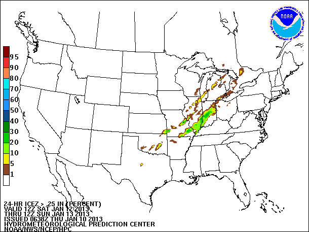
We are less than 24-hours from the start of the event and the computer models should be getting a pretty good handle on the system coming together.  The NAM, GFS and European computer models are all pointing to freezing rain and/or sleet for the St. Louis metro area along with parts of southeast Missouri, south/central Illinois and west-central Indiana.

Having said that, I want everyone to keep in mind that this is going to start as rain, heavy at times, Saturday.  There could even be a few strong to severe storms over Arkansas, the Missouri bootheel and Tennessee.  Further north, north of the cold front, cold air at the surface will begin to undercut warm air 1,000 to 2,000 feet above the ground.

Here is the meteogram for freezing rain accumulation (ice) in St. Louis:
Click image to see larger version.
The data in the above image shows the GFS suggesting 0.5" of freezing rain (ice) accumulation for St. Louis.  That could be enough to cause some power issues if ice collects on power lines.  It also isn't out of the question for there to be a dusting to an inch of snow laid down on top of the ice before the moisture finally exits.

Further south, models are suggesting freezing rain accumulations 0.5" to 1" for a few areas of southeast Missouri.  At this time, I think places in the Missouri bootheel and Sikeston/New Madrid will keep the precipitation as a cold rain and not sleet or freezing rain.

As I have said many times before, if the track of the storm shifts even as little as 40 miles north of south, the end product could change.  Some areas of Missouri, Illinois, Kentucky and Indiana will only see rain, others will see a lot of rain with sleet mixed in and some will see freezing rain and/or sleet.

I mentioned timings in my previous post and I think those still hold relatively the same.

FREAK-OUT-METER:
  • St. Louis metro:  5
  • Southeast Missouri:  4 - There will be a wide range of precip type from north to south across southeast Missouri and the Freak-Out-Meter could range from 1 to 4 depending on specific location.
  • Southern Illinois: 3
  • Western Kentucky:  2
  • Central Indiana:  3
Bottom line... I do believe there will be freezing rain in some areas.  This won't be of the severity of the 2009 Ice Storm but this could make things slick in some places.

Should you go out and stock up on weeks of supplies?  No.  Would I go out and get a can of deicer to have on hand?  I would.  Worst case... If this doesn't pan out, you end up with an extra $3 can of deicer you can use at a later time.

Friday, January 11, 2013

3:00pm Weather Update: Shift in Time

The morning computer model data is in and everything appears to be running straight and normal.  That means that all of the various computer models have different solutions to the Sunday-Tuesday time frame.

One thing that is becoming more apparent is the time frame.  Everything seems to be pointing to a slightly earlier and not as long of duration for wintery precipitation.  The way it looks now…
  • St. Louis metro:  Saturday night through early Sunday morning.
  • Southeast Missouri:  Sunday morning through early afternoon.
  • Southern Illinois:  Sunday
  • Western Kentucky:  Sunday afternoon through Sunday evening.
  • Central Indiana:  Sunday afternoon through Sunday evening.
The precipitation type is still too early to pin down.  I don’t think snow is going to be a big player.  In a few locations there could be a brief period of snow but the bigger deal will be either sleet and/or freezing rain.

A quick breakdown of what the models are suggesting…
  • European Forecast Agency global model (ECMWF):  Continues to suggest a layer of warm air (above freezing) a few thousand feet above the surface with cold air (below freezing) undercutting the warm air.  This would be friendly to freezing rain/sleet production.
  • NOAA’s global forecast model (GFS):  Is starting to trend the way of the Euro by keeping a layer of slightly warmer (above freezing) over the top of cold air (below freezing).  This would lean more towards sleet with maybe freezing rain.
  • North American Mesoscale Model (NAM):  Suggests air type (cold or warm) will arrive through the entire column (both at the surface and a few thousand feet up).  This would keep it either snow or rain depending on location.
Finally, here is the latest meteogram for St. Louis.  This shows computer model projections of freezing rain accumulation.  Each colored line is a different computer model run.  The white line indicates the average of all the forecast models.  Note:  The meteogram does not display European computer model.
Click image to see larger version.
I’m starting to think there could be a band of icing that runs from the Arkansas/Missouri border eastern/southeast Missouri through southern Illinois and in to west central Indiana.  Some of the locations that could be impacted would be St. Louis, Perryville (MO), Carbondale, Effingham, Terre Haute, Indianapolis, Bloomington (IN) and Columbus (IN).  (Before people start to question… No, these are not ALL of the locations, these are SOME of the locations.)

Bottom line… There will be a decent amount of rain falling Saturday.  Eventually the rain should change over to something.  There are still several details that need to be ironed out, but the potential does exist for ice but at this point.  For those in southeast Missouri and western Kentucky this does not look to be anything like the 2009 ice storm.

FREAK-OUT-METER:
  • Southeast Missouri:  3
  • Southern Illinois:  3
  • Western Kentucky:  2
  • Central Indiana:  3
  • St. Louis metro:  3

Thursday, January 10, 2013

5:10pm Weather Update

Continuing to keep an eye on the Sunday-Tuesday time frame for parts of Missouri, Illinois, Indiana, Arkansas, Kentucky and Tennessee as the possibility of wintery weather exists.

Morning computer model data is in and the battle lines are still drawn.  NOAA’s global forecast model, the GFS, continues to bring in cold air at both the surface as well as a few thousand feet up in the atmosphere.  The European forecast agency’s computer model, the ECMWF (Euro), continues to bring shallow cold air near the ground in under “warmer” air a few thousand feet up.  The GFS suggests rain with a brief changeover to snow before the moisture moves out.  The Euro has moisture overrunning the cold air which would fall as rain and then freeze near the ground.

A couple of quick meteograms.  First, a look at surface the surface temperature in St. Louis.  Pretty obvious when the cold front passes.
Click image to see larger version.
Next, a look at freezing rain accumulation for Evansville, IN.  Note the scale on the left side of the image.  It keeps the accumulation minimal.
Click image to see larger version.
The latest forecast from the Hydrometeorological Prediction Center keeps the possibility of freezing rain/sleet in the forecast from 6pm CT Saturday through 6pm CT Sunday.
Click the image to see larger version.
The above is a probability forecast for 0.01" or more of ice.

There has been a subtle shift to the southeast in this morning’s run of the European forecast model, but I think it is too early to get in to details like that as the data will flip-flop around a bit over the next couple of days.

A forecaster from the National Weather Service office in Paducah, Kentucky described it best in their afternoon forecast discussion… “There is little reason to expect these rather subtle details to be handled well by the models at this time range… Will have to wait for a better, more coherent, clue which may not show up until Saturday.”

FREAK-OUT-METER:
  • Southeast Missouri: 3
  • Southern Illinois: 3
  • Western Kentucky: 3
  • Central Indiana: 3
  • St. Louis metro: 3

HPC Puts On Their Skates

Taking a quick glance of data this morning concerning Sunday-Monday and the possibility of freezing rain.  Last night’s European computer model (ECMWF) continues to be bullish on the potential whereas NOAA’s global forecast model (GFS) is downplaying the icing side.

One thing the models are in agreement about, rain, heavy at times, will fall Saturday night through early Sunday morning.  A cold front will be slowly moving through Missouri, Illinois and Indiana at the time.  There will be shallow cold air behind the cold front while a few thousand feet up in the atmosphere winds out of the southwest will keep temperatures above freezing.  There are two big questions at this time:
  1. How long will water be available?
  2. Where will be the location of the cold front?
Most likely, just north of the front will see freezing rain.

The Hydrometeorological Prediction Center is getting in on some of the freezing rain chatter.  There latest Day 3 Freezing Rain Probability Forecast and Day 3 Freezing Rain Accumulation Forecast is out and includes parts of Arkansas, Missouri, Illinois and Indiana.  The images below look at the Saturday night through Sunday morning time frame.

24-Hour Probability of Freezing Rain Accumulation 0.01”+:
Click the image to see larger version.
24-Hour Probability of Freezing Rain Accumulation 0.25”+:
Click image to see larger version.
48-Hour Freezing Rain Accumulation – 95th Percentile:
Click image to see larger version.
Notice how HPC keeps the freezing rain out of western Kentucky, southern Indiana and northeast Arkansas.  The European computer model has the freezing rain going further south in to those areas.

Will the models continue the way of the GFS, keeping the freezing rain away, or will they lean towards the Euro, hinting at an ice storm?  We’ll have to wait and see what the runs come in with over the coming days.

FREAK-OUT-METER:
  • Southeast Missouri: 3
  • Southern Illinois: 3
  • Western Kentucky: 2
  • Central Indiana: 2
  • St. Louis metro: 3

7:20am Weather Update: Severe Weather

A quick update to highlight the latest severe weather outlook from the Storm Prediction Center.


The SPC has put parts of southeast Missouri, western Kentucky, western Tennessee and northeast Arkansas in a "Slight Risk"for severe weather. The outlook runs through 6am CT Friday.

According to SPC forecasters, the main threat will be damaging winds, however with the amount of winds turning with height a couple tornadoes could be possible.

Instability is somewhat lacking with the setup so the big questions is if organized storms will develop.

The window for the potential severe weather appears to be anywhere from 6pm through just past midnight.


- Posted from my iPhone

Wednesday, January 9, 2013

Wet and Slick Weather Ahead

Quite a few weather “things” coming to the Midwest over the next five to six days and there are still a lot of question marks as to what will hit the ground.  One thing is for sure, there will be a significant and beneficial amount of rain falling at least through Sunday.  In some instances, upwards of 6” of rain could fall in parts of Missouri, Illinois and Kentucky.

Here is the Hydrometeorological Prediction Center’s precipitation forecast for the next five days.
Click image to see larger version.
If the computer models are correct, the numbers on the map (above) might be on the low side of reality.  Just through Friday, a four computer model average for rainfall is:
  • Cape Girardeau:  0.96”
  • Indianapolis: 0.89”
  • Paducah: 1.32”
  • St. Louis: 0.96”
Considering much of the area is still well below normal (precipitation), the rains will definitely be beneficial.

CLEAR SLICK STUFF

Now  the main reason for writing this post… What comes Sunday/Monday.

In the next 24-48 hours I think you are going to start to hear television meteorologists/weather-peeps starting to mention “freezing rain” (a.k.a. ice).  Freezing rain isn’t fun as it only takes a very small amount to make things slick.

The temperature profile of the atmosphere will be a HUGE factor in determining what type of winter weather will reach the ground.  It is the changing temperatures with height that makes winter forecasting the most difficult.

Instead of going in to detail how each type of winter precipitation is formed, check out the following links for tutorials from the University of Illinois on how the various winter weather types are formed.
Ok, now that you have a better understanding of how the different precipitation types form, let’s take a look at what some of the computer models are advertising for a few select locations.  (Note:  This is just an overview of what a few locations could see.  The data used is coming straight from computer models and is not the forecast.  It is also subject to change, and likely will.)

For the last couple of runs, computer models are hinting at cold shallow air to be in much of the Midwest.  The cold air is scheduled to arrive late Saturday night through Sunday depending on your location.  The models have temperatures slightly above freezing at 5,000 feet and  how thick that “warm” layer is will determine the type of precipitation hitting the ground.

This is a meteogram for St. Louis.  Each line is a representation of a different run of a computer model’s prediction of freezing rain accumulation.
Click image to see larger version.
The light blue line shows the amount of freezing rain accumulation from this morning’s run of NOAA’s global forecast model, the GFS.  Disregard the dark blue line (comes from the 6z GFS which I hold little faith in).

Not shown in the above meteogram is the European forecast agency’s computer model, the ECMWF.  The Euro is suggesting 0.59” of rain may fall while temperatures at the surface are below 32°F.  (Keep in mind that not all precipitation falling accumulates.  That is a reason for difference in numbers.)

Here are meteograms for a few other locations along with how much precipitation is projected to fall by the Euro.

Cape Girardeau, Mo:   Euro – 0.63”
Click image to see larger version.
Indianapolis, In:  Euro – 0.60”
Click image to see larger version.
As we get closer to Sunday the models should get better at predicting the minute details needed for determining precipitation type. 

Bottom Line… What I want you to take away from all of this is that there is a chance we could see freezing rain Sunday in to early Monday morning (timing varies by location).  It could also fall as all rain or sleet.  There are still considerable uncertainty as to what will fall.

I know many are skittish after the 2009 ice storm but as of today I do not think this will be anywhere near that storm.  As you will see below in my “Freak-Out-Meter”, I don’t think you should be freaking out nor should you be stocking up supplies to go weeks without power.  Instead, what I think you should do is keep an eye on the forecast over the next couple of days, maybe beat the lines and grab a can of deicer and a few batteries.  Worst case (for me anyway), this doesn’t pan out and you’ve got an extra can of deicer and batteries.

FREAK-OUT-METER:
  • Southeast Missouri: 2
  • Southern Illinois: 2
  • Western Kentucky: 2
  • Northeast Arkansas: 2
  • St. Louis Metro: 3
  • Central Indiana: 2

Monday, January 7, 2013

Tornado: 2012 Year in Review

Now that we are a week in to 2013, annual weather statistics are starting to be published.  The Storm Prediction Center has put out their 2012 annual tornado statistics, “UnitedStates Tornadoes of 2012”.  It is an interesting read if you are in to severe weather.

(Courtesy: Jennifer Wasyliw Gasm)
A couple of interesting stats I’ve pulled out from the list.
  • 46 states had at least one tornado.
  • Approximately $1.6-billion in property and crop losses due to tornadoes.  That is down 84% from 2011.
  • The number of tornadoes in 2012 was approximately 20% lower than the 30-year national average.
  • About 60% of tornadoes from 2012 were rated EF-0 with winds 65-85 mph.
  • When EF-0 tornadoes are subtracted from 2012 total, the remaining EF-1 and stronger tornadoes will place 2012 among some of the least active years in the past 60 years.
 Nationally, the months with the top 5 number of tornadoes:
  1. April
  2. March
  3. May
  4. June
  5. January
Those top 5 months aren't surprising, although I am sure number 5 might make you think.  There is a secondary severe weather season during the winter.  Just an example that tornadoes can occur any time of year.

Friday, January 4, 2013

Polar Orbiting Satellites and Computer Models

Did you know that satellites had a role in forecasting the path of Hurricane Sandy almost a week in advance of the storm impacting the northeast United States?  Some interesting information about what goes in to making an accurate storm forecast by Dr. Jeff Masters.

The image (below) shows the difference between the European forecast agency’s computer forecast model’s prediction of where Hurricane Sandy would be located with satellite data inputs into the model (left) versus the predicted location without the satellite data added (right).
Click image to see larger version.
Without the satellite data included in the model run, residents along the northeast coast would have had less warning of the impending storm.  I recommend reading the blog post.

You hear me reference the European forecast agency’s computer forecast model quite a lot.  There is a reason… I have a lot of trust in the model.  The agency puts a tremendous amount of effort ingesting a lot of current weather data in to the model and the work makes for a more accurate computer model.

Thanks to KMOV’s Steve Templeton for spotting the article and passing it along.

Thursday, January 3, 2013

Moving on Up

We always hear talk of what the temperature is like outside.  When people talk about the temperature, they usually refer to temperatures at the surface of the earth.  Occasionally, you also see me reference temperatures 3,000 – 5,000 – 15,000 feet up.  But what about 90,000 feet up?  You might be surprised at how warm it is.
Click the image to see larger version.
Over northern parts of Russia the temperature the temperature at 90,000 feet or 30,000 meters is between 40° and 47° F.  (Note, the image has temperatures listed in Celsius.)

On the flipside of the hemisphere, over the northern Atlantic the temperature is as cold as 123° below zero.  And here I thought it was cold Tuesday morning when the temperature hit 15° in St. Louis.

What are surface temperatures currently like over northern Russia where the upper air temps are “warm”?
Click the image to see larger version.

The above image is a plot of surface temperatures in Fahrenheit.  As you can see, in some places, the surface temperature is colder than temperatures at 90,000 feet.  That means there is an inversion.

The warmer air is forecast to move to northeast Russia over the next 5 days per the next map.
Click the image to see larger version.
Have to give credit to Ryan Maue for tweeting the image of what temperatures look like 90,000 feet in the atmosphere.


COLDEST MORNING SINCE...

I mentioned above that the temperature dropped to 15° Tuesday morning.  That temperature was for Lambert airport in St. Louis.  That is the coldest temperature in St. Louis since January 18, 2012 -- 351 days.

Wednesday, January 2, 2013

Snow Covers Far and Wide

Amazing what four days can do to for a winter’s snow totals.  Two storms and in some cases more than 20” of snow has fallen across parts of the Midwest.

It all started last Tuesday/Wednesday as upwards of 18” of snow fell in parts of Missouri, Illinois and Indiana.  Then Friday night/Saturday morning another couple of inches of snow fell.

According to the National Operational Hydrologic Remote Sensing Center, 76.6% of the Midwest was covered with snow this morning.

(January 2, 2013 Snow Depth - Click image to see larger version)

Compare that to a year ago when only 0.6% of the Midwest was covered.

(January 2, 2012 Snow Depth - Click image to see larger version.)

Even a person not great at math can figure out that is a HUGE increase in snow.

Nationally, as of this morning 65.8% of the continental United States was covered by snow.  Whereas last year only 18.7% was covered.

(January 2, 2012 Snow Depth - Click image to see larger version.)
For those of you that do not like snow, you will like the next 6-8 days as forecast models suggest a quiet weather pattern.  Temperatures may even moderate a little early next week but winter is far from being done.