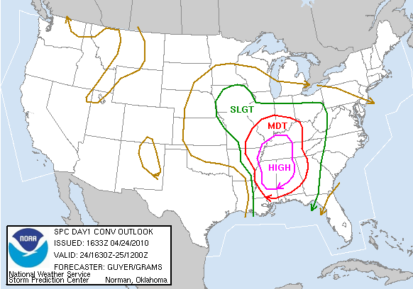
All of western Kentucky and northwest Tennessee and parts of southeast Missouri and southern Illinois are included in the "High Risk" area. The remainder of the KFVS viewing area is under a "Moderate Risk" area.
Here is the Tornado probabilistic outlook:

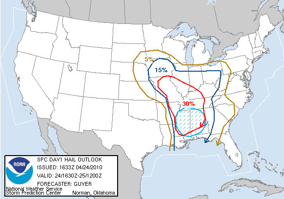
Here is the Hail probabilistic outlook:
Here is the Damaging Wind probabilistic outlook:

Everyone should be on their toes today keeping an eye to the sky. Take a minute right now to think about what you are going to do/where you are going to go if a Tornado Warning is issued for your location.
1 comment:
So I am confused, help me out here. At first this would all be out of here by early evening and the greatest threat was West Tennessee and Kentucky, now we are all under a Tornado Watch until 8:00 but the Storm Prediction Center has us under high risk till Sunday morning. Which is it please if someone knows, this is just very confusing with the mixed messages.
Post a Comment