To note, the threat has shifted slightly further north according to SPC forecasters.

While I am not a fan of the "Enhanced" and "Marginal" outlook areas it is of interest to note the location of what I'd refer to as a "heightened" risk for severe storms. In fact, the enhanced area lines up with the area I suggested of "greatest risk" earlier today.
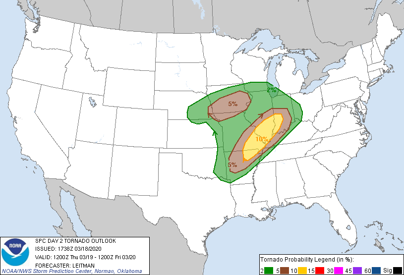 |
| Tornado Probability 8am EDT Thursday through 8am EDT Friday |
 |
| Computer model projection of power outages through Friday morning. |
Storms in Missouri will likely occur the afternoon/early evening. Storms in southern Illinois and western Kentucky will likely occur during the late afternoon/evening. The window for storms in Indiana will be evening in to the night.
I'll post another update this evening as more data becomes available.
On a side note... I am considering providing live streaming coverage of storms Thursday evening/night. Is that something you would watch? Let me know by leaving a comment.
No comments:
Post a Comment