
Also included in the Moderate Risk area: Little Rock and Memphis
The forecaster at SPC has also increased the probability area and the hatched area. (See previous post for more information about probabilities and hatched areas.)
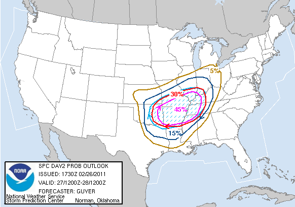
I am just reading through the discussion by the forecasters that prepared the above outlook. They say, "A regional outbreak of severe thunderstorms... including the possibility of widespread damaging winds/strong tornadoes... seems probable late Sunday afternoon and especially Sunday night."
Again... If you do not have a NOAA weather radio I STRONGLY suggest picking one up today or tomorrow. The storms will most likely come through during the overnight hours while many are sleeping. The radio will alert you to warnings as they are issued overnight.
I also suggest that you purchase a NOAA weather radio with S.A.M.E. technology. This allows you to program individual counties so you are only alerted for those specific locales.
You can pick-up a StormTeam Weather Radio at Orscheln stores around southeast Missouri, southern Illinois and western Kentucky for $29.99. More information at www.kfvs12.com/weatherradio.
It is also a good time to give yourself a little "Severe Weather Safety Check Up". If a tornado warning is issued for your location in the middle of the night, what will you do? Where will you go?
I will be working this severe weather event. Depending on how busy it gets and if there is interest, I may take my laptop and webcam in to work and put a live stream up here on my blog.
No comments:
Post a Comment