Wednesday, January 6, 2010

3:00pm Weather Update

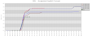
Here is a look at potential snowfall amounts from four runs of the GFS and the NAM computer models. The bright red line is the 12z NAM. The bright blue is the 12z GFS. Those are the latest runs.

Cape Girardeau, Missouri:

Farmington, Missouri:

Paducah, Kentucky:

St. Louis, Missouri:

Sorry for the lack of updates today. I have been busy getting our website, www.kfvs12.com, ready for tonight and tomorrow. We have some cool new things to keep you informed during the storm. You can now watch the StormTeam Weather Network live on your computer or on your iPhone/iPod Touch.

10:00am Weather Update

Winter Storm Watches have been reworked to Winter Storm Warnings and Winter Weather Advisories for southeast Missouri, southern Illinois, western Kentucky, northwest Tennessee, and northeast Arkansas. A Winter Storm Watch remains in effect for central Indiana.


I am making my round of conference calls with different National Weather Service offices. Currently, I am on the phone with the Memphis, Tennessee office. They have backed down on their snowfall forecast. Their forecast comes back closer to our forecast of 1-2" for northeast Arkansas and northwest Tennessee. Next up will be a call with the Paducah, Kentucky office.

I am just starting to look at some of the new overnight/morning weather data. My forecast is still looking pretty intact as is. I might be making a few slight adjustments (increasing) to amounts in eastern portions of southern Illinois.

Tuesday, January 5, 2010

10:45pm Weather Update

New data is coming in tonight. Specifically, I am paying attention to how much moisture the storm might have to work with.

The 0z (6pm CT) NAM run is now in. That is the latest data available. I am still feeling pretty good about my snowfall forecast. The only thing that might be adjusted is the timing of when the snow gets here. Initially, I was thinking the snow would reach the Cape Girardeau, Missouri area around 8:00pm-10:00pm Wednesday evening. It might start 3 to 4 hours later.

Here is a look at graphs of snowfall accumulation for specific locations around the region.

Cape Girardeau, Missouri:

Farmington, Missouri:

Paducah, Kentucky:

St. Louis, Missouri:


Indianapolis, Indiana:


On the graphs you will see several different lines. Each line represents a specific run of a computer model and one represents the National Weather Service forecast snowfall accumulation.

As mentioned earlier, the 0z (6pm CT) run is the latest data. Next is 18z (12pm CT). After that is 12z (6am CT).

Snow Forecast

Hot off the presses. Ok, really the computer screen. Here is my snow forecast for the Wednesday night/Thursday "storm".


There is a chance the computer models are a little too dry for some of the Tennessee, Missouri bootheel, and northeast Arkansas counties. If that is the case, those numbers could be pushed up a little.

This isn't going to be a big winter storm as far as snow is concerned. So there is no need to run out and stock up on bread, milk, and eggs. However, it is going to be very cold Thursday-Sunday. Thursday afternoon might be spent in the lower teens. Temperatures could possibly drop below zero by Friday morning.

Winter Storm Watch

The National Weather Service offices in Paducah, Kentucky and Memphis, Tennessee have issued Winter Storm Watches. The watches will be in effect Wednesday evening through Thursday afternoon.


Here is a list of current winter storm watches, warnings, and advisories.

I will be going over data this afternoon and hope to have a snow forecast later today.

Sunday, January 3, 2010

Thowing Numbers

Everyone keeps asking for me to "throw out some numbers" in regards to the amount of snow we could see for Wednesday/Thursday. I am a little reluctant to do this as everyone then takes this as a forecast amount, but what the hay...

As of the way things look right now, and early guestimate would be for us to see 2" to 6" of snow around the southeast Missouri, southern Illinois, and western Kentucky area Wednesday evening through Thursday.

I want to stress that this is NOT my forecast. This is an early guestimation of what the models are showing right now. Things will undoubtably change between now and Tuesday when we will have a better handle on how much snow we could get.

By the way, the National Weather Service in Paducah, Kentucky sent out a statement this afternoon regarding the snow and cold temperatures for later in the week. Below is the text from the Special Weather Statement they issued.

SPECIAL WEATHER STATEMENT
NATIONAL WEATHER SERVICE PADUCAH KY
231 PM CST SUN JAN 3 2010

...WINTER WILL CONTINUE ITS GRIP ON THE REGION...WITH SNOW POSSIBLE
DURING THE MIDDLE PART OF THE WEEK AND COLD CONDITIONS CONTINUING...

IT APPEARS MORE AND MORE LIKELY THAT THE REGION WILL SEE ACCUMULATING
SNOW FALL...MAINLY WEDNESDAY NIGHT AND THURSDAY...WITH A STRONG STORM
SYSTEM FORECAST TO MOVE ACROSS THE REGION. PRELIMINARY INDICATIONS
SUGGEST MODERATE ACCUMULATIONS MIGHT OCCUR...WITH AMOUNTS UP TO 4
INCHES POSSIBLE ACROSS SOUTHEAST MISSOURI...SOUTHERN ILLINOIS...
SOUTHWEST INDIANA AN WESTERN KENTUCKY. MOST MODELS PROJECT 1 TO 3
INCHES WITH ISOLATED HIGHER AMOUNTS. THESE AMOUNTS ARE PRELIMINARY...
AND COULD CHANGE SHOULD FORECAST MODELS ADJUST THE STORM TRACK ONE
DIRECTION OR ANOTHER...OR SUGGEST NOT AS MUCH MOISTURE WILL BE
AVAILABLE FOR SNOW. SO STAY TUNED TO THE LATEST FORECAST...AS IT
MAY BE SUBJECT TO MODIFICATIONS. IF THE FORECAST STAYS ON
TRACK...ADVISORIES MAY EVENTUALLY BE ISSUED.

MEANWHILE...THE MUCH COLDER THAN NORMAL WEATHER WILL PERSIST. HIGHS
FOR THE MOST PART WILL CONTINUE TO STAY IN THE 20S TO NEAR 30...WITH
SINGLE DIGIT OR TEEN WIND CHILL TEMPERATURES THE RULE. AT NIGHT WIND
CHILL TEMPERATURES COULD DROP EVEN LOWER...ESPECIALLY LATE IN THE
WEEK.

PERSONS SHOULD MONITOR THE WELL BEING OF THOSE THAT MAY SUFFER MORE
FROM THE EFFECTS OF THE COLD...ESPECIALLY THE ELDERLY AND YOUNG
CHILDREN...OVER THE NEXT SEVERAL DAYS. MOST KIDS WILL BE HEADING
BACK TO SCHOOL THIS WEEK. EACH MORNING WILL BE VERY COLD. IF
NECESSARY...PRECAUTIONS SHOULD BE TAKEN TO ENSURE PIPES DO NOT
FREEZE. MAKE SURE PROPER MAINTENANCE HAS BEEN DONE ON YOUR VEHICLE
IN ORDER TO BETTER PERFORM IN THE COLD WEATHER.

On the Snow Watch

Here we go again. Watching another potential winter storm. So far this season, this one looks to have the best chance of being a snow machine than any of the others.

We are still several days away from the storm dumping snow on southeast Missouri, southern Illinois, western Kentucky, northeast Arkansas, northwest Tennessee, and southern Indiana. The storm would start to affect the area starting Wednesday with clouds. Eventually, enough moisture will fall to saturate the column of air over the top of us and allow for the snow to make it to the ground. The heaviest snow would fall Thursday.

Want to have some fun? Lets take a look at some of the snowfall totals the computer models are hinting at. I have to stress, this is NOT my forecast. This is only the output from a computer model.

Cape Girardeau, Missouri:


Farmington, Missouri:


Paducah, Kentucky:


Each line represents a different run of the GFS computer model. We have to use the GFS for now as that is the only model, that I have access to, that puts out snowfall amounts that far in to the future.

The nice thing about this storm will be that we are talking all snow for everyone. It doesn't appear we will have to be dealing with our usual rain/snow line.

Lets now take a closer look at what the GFS is showing for Cape Girardeau.


If you are new to the blog, time runs from right to left on the above graphic. The red line is the surface temperature. The blue vertical bars indicate snow.

Notice the model tries to bring in snow late Wednesday night. I don't think we'll see snow that early due to the dry air in place (previously mentioned). However, the column should saturate pretty quickly.

Note: Don't take the times of too much to heart. As I said earlier, this is still 120 hours away. There will be a lot of rough and fine tuning by the model over the next couple of days.

The other thing I want to point out. Look at the cold air coming down! We will be tapping in to the core of the coldest air over Canada, the Polar Vortex.

Here is the European forecast agency's computer model look at the cold air coming down. This image is for 6pm CT Thursday.


If you watched Heartland News at 6pm and 10pm Saturday, you might have heard me talking about cold air for the end of the week. Thursday's high temperature will come early and then temperatures will plunge the rest of the day. I was calling for a high of 21° Friday, but as I said, temperatures could easily be much colder. If we have a decent snow pack on the ground, temperatures might struggle to get out of the lower teens. Stay tuned...

If this storm comes to truth, will this impact school? When do students go back to school?

Saturday, January 2, 2010

A New Year; Cold Temperatures

Happy New Year!

Right on cue, and as previously advertised, the cold air has taken hold of the Midwest. Take a look at temperatures from 10:43am CT.


Unfortunately, it looks like we will have to get used to the cold air. Here is a look at forecast temperatures for Cape Girardeau, Missouri from one of the computer models.


If you are new to the blog, when looking at the above data, time goes from right to left. Also, time is listed in ET not CT. The red line is the air temperature.

Notice that the model is forecasting high temperatures in the middle 20's and lows in the teens. Forecast wind chills, not listed on the image, are in the single digits. Hopefully grandma gave you a new winter coat for Christmas.

If you are astute you might have notice the blue vertical bars. Yes, that is snow. I'll deal with that when I get in to work and take a closer look at things. I am just back from a week and a half off on vacation and I'll be in for work later today.

Here's wishing to a fun, eventful (but not too eventful), and safe weather year!